Two Rivers, Two Towns, One History

The Display Committee at 2RHM compiled a large number of interesting and notable historic photographs. These images represent notable places, and show the ways people lived, worked, and played in the Camas-Washougal area since the dawn of the consumer camera, and thus more widespread photography, in the late 1800s.
Travis London then chose some of those photos as inspiration for his mural.

Explore the images that Travis London chose to utilize below!
Learn when and where each photo was taken, and learn about why each image was chosen to be part of the mural.
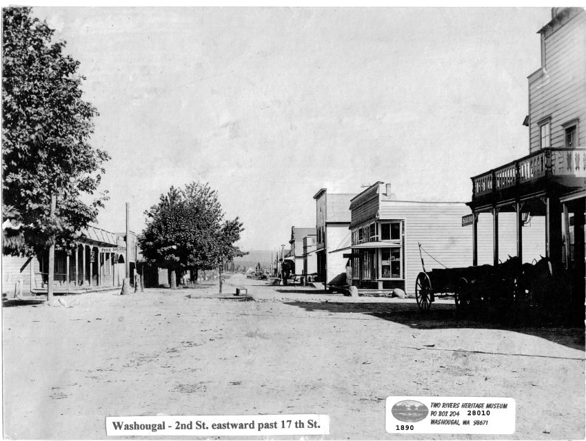
1890 - Town Pump
Located in Washougal, the Town Pump was quite literally at the center of town. Today, on Reflection Plaza, the Campanile, titled Two Rivers Heritage Sculpture, stands on the site where the town pump once stood. The old town pump, after being removed when indoor plumbing came to town, spent some time on display at Washougal City Hall before being relocated to the Carriage House at the Two Rivers Heritage Museum.
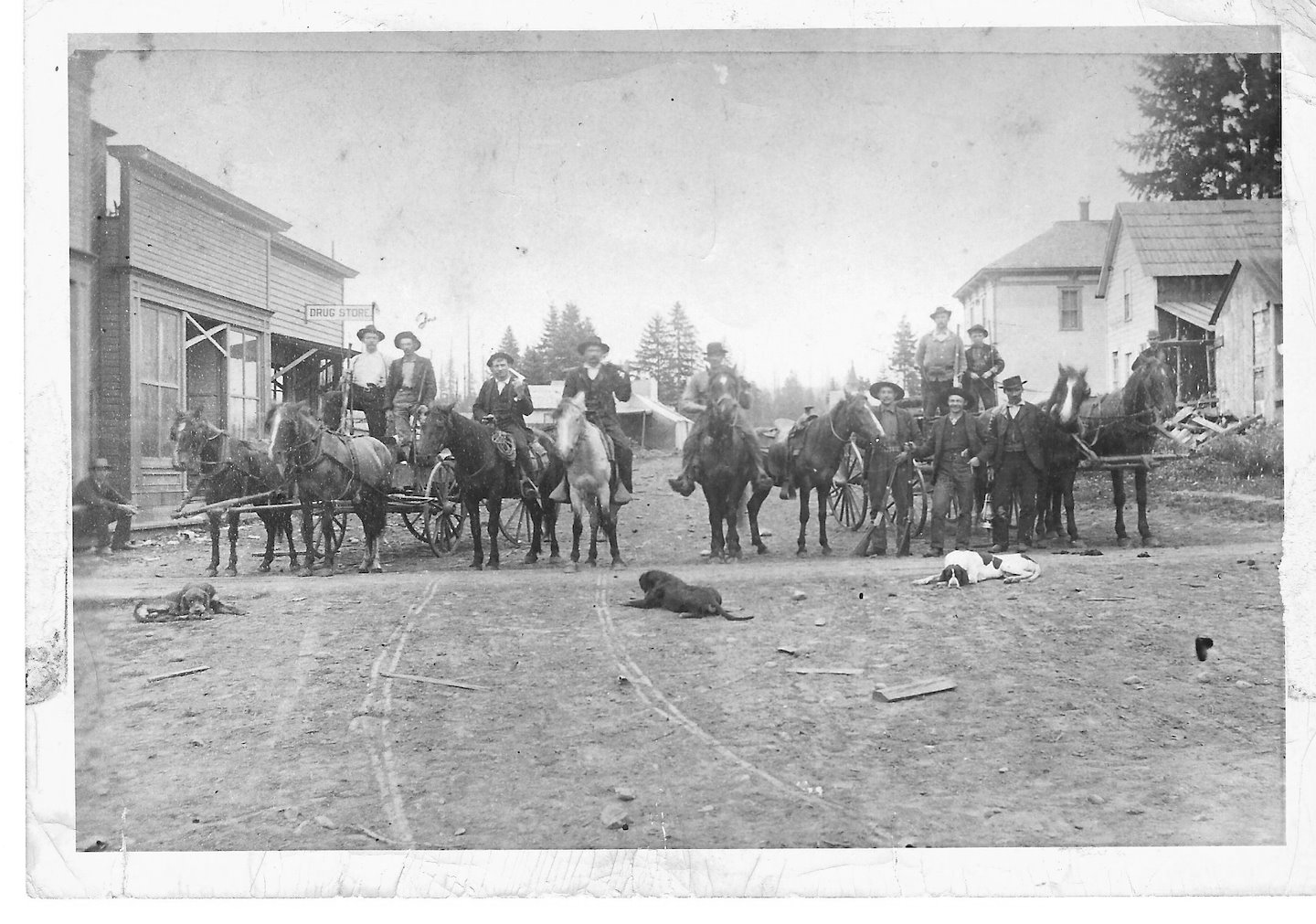
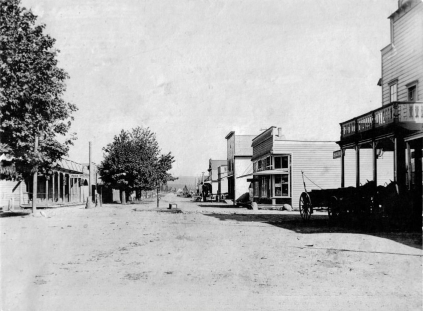
1880s - Men on Horseback
Located on Main Street in Camas, in front of the Mountain House Hotel. This is how Camas looked in the 1880s. A group of men lined up on Fourth Avenue, with their dogs lazing about, like a reminder of the slower pace of life. Most of the men are carrying rifles and/or pistols, a more stark reminder of how different life was back then.

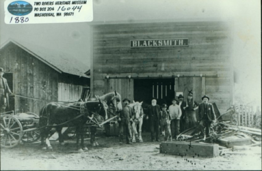
1903 - Sam Jones' Blacksmith Shop
Blacksmith Sam Jones owned the shop located on the corner of Washington and Second Streets. Blacksmithing in Washougal traces its roots to the region’s early pioneering and agricultural days in the mid-19th century. As the area grew from a rugged settlement into a timber and mill town, local blacksmiths were the lifeline of the community, forging and repairing essential tools, farm equipment, and wagon parts.
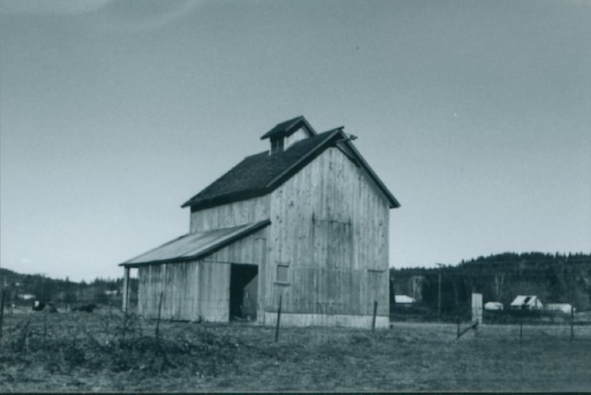
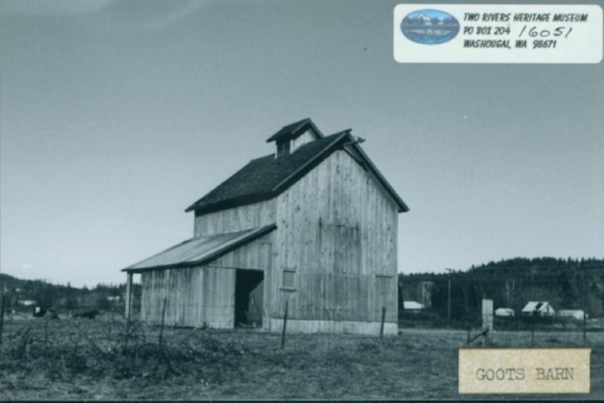
1907 - Goot-Husby Barn
The iconic 3 story Goot-Husby dairy Barn was constructed around 1907. It was a historical landmark until it collapsed in 2006. Today, a portion of the original Goot family farmland is preserved as Goot Park, located near the Washougal River Waterway.
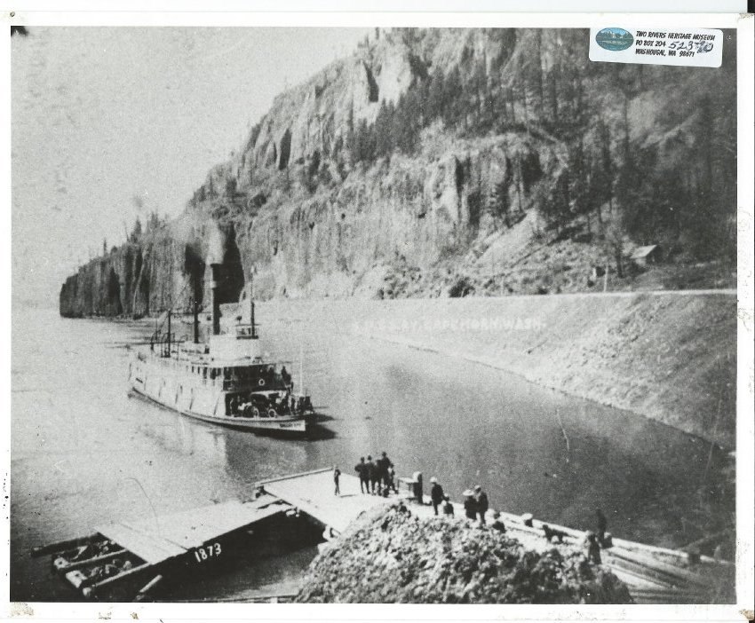
1910s - Dalles City Sternwheeler
Riverboats hauled freight and people between the numerous communities along the Columbia River. Shallow draft sternwheelers could navigate the river’s shoals and stop at any sandy bank along the river.
The Dalles City, built in 1891, wasn’t fancy but was a workhorse that kept her schedules, carrying sacks of grain, barrels of apples, bolts of yard goods and assorted merchandise along with passengers. The Dalles City had thirty-seven landings on her schedule, sashaying back and forth across the river.
The Dalles City it was 345 tons, 151 feet long. It was renamed in 1920 as the “Diamond D,” under which name it ran until 1935.
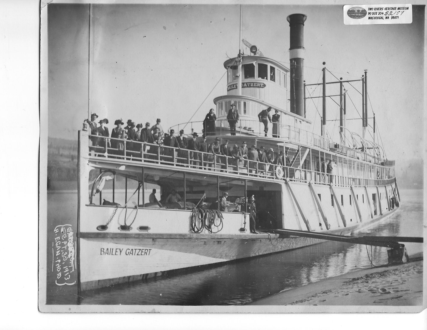
1913 - Bailey Gatzert Sternwheeler
The Bailey Gatzert was fast! Built when racing was popular among passenger steamboats, the stately Bailey Gatzert was a contender, making it from the Dalles to Portland in a little over five hours. It was one of the most famous Columbia River excursion boats and was commemorated during the 1905 Lewis and Clark Exposition with a song named “The Bailey Gatzert March” and a 1996 stamp, below.

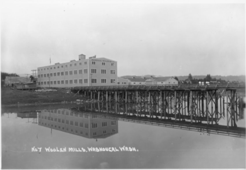
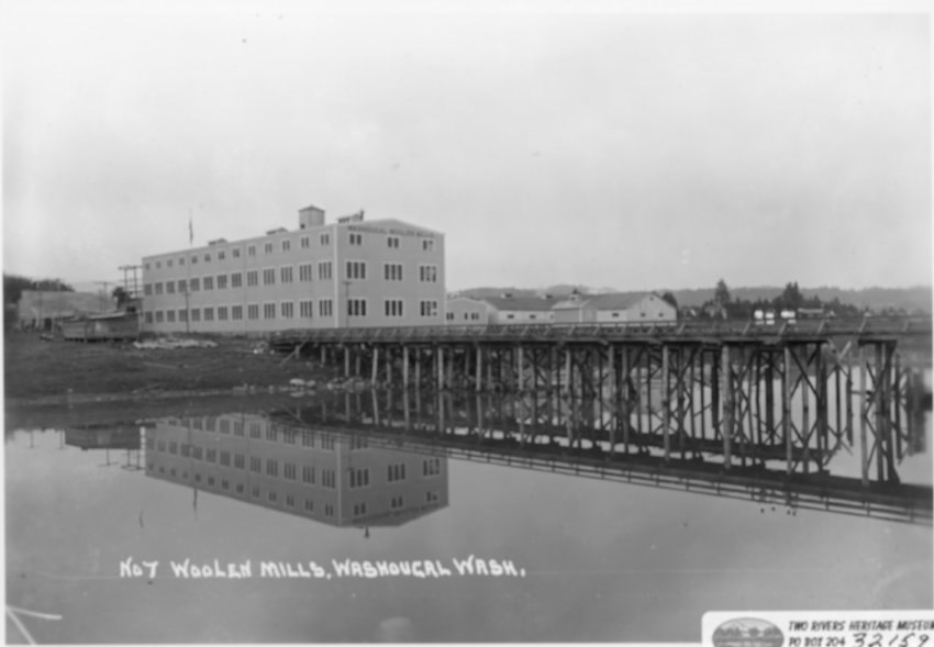
1915 - Pendleton Woolen Mill and Dock
Reincorporated and renamed from Washougal Woolen Mills to Pendleton Woolen Mills in 1953.
Pendleton Woolen Mills’ history in Washougal began in 1912 when the Bishop family purchased an existing, struggling local woolen mill. Today, it is one of the last few remaining vertically integrated woolen mills in the United States, producing signature blankets and clothing.
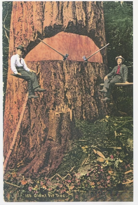
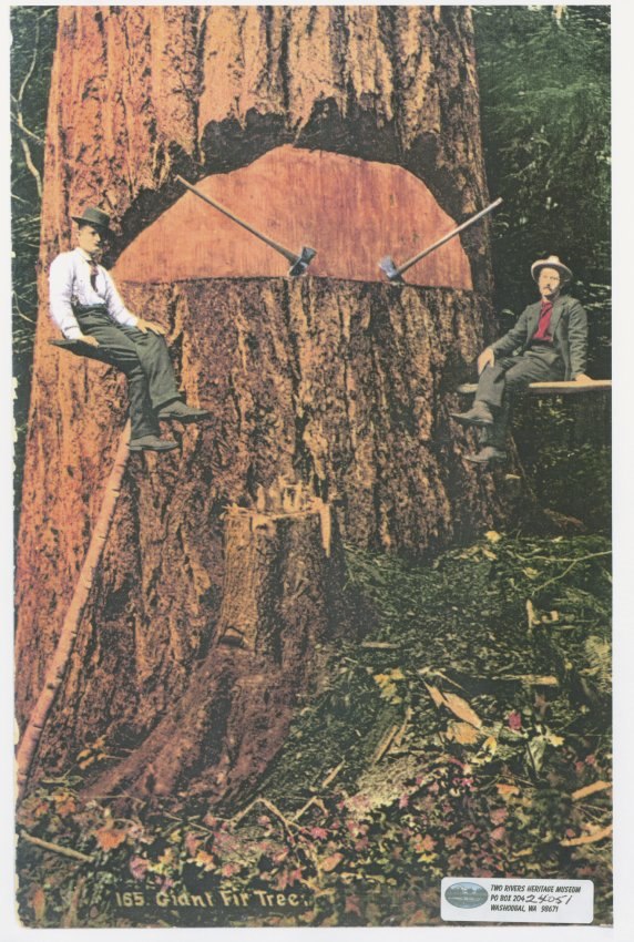
1920 - Men Sitting on Springboards
Logging was an important industry in both Camas and Washougal. Springboards were essential tools in old-growth logging used to elevate loggers above the massive, flared root systems and dense sapwood of large trees.
1920s - Lauderdale Family, Martha Ford Estate
The first automobiles arrived in Washougal between 1900 and 1910. In the early 1900s, automobiles were rare, expensive novelties that shared rough, unpaved roads with horse-drawn carriages. The region lacked proper highways, gas stations, and bridges.
Martha Kloninger Ford was a member of the Camas-Washougal community for most of her adult life, and the City of Washougal’s former Mayor Charles Crumpacker declared September 25, 1993, as Martha Ford Day, in honor of this long-living, founding member of this area of SW Washington.
Martha was born near Little Washougal River on September 25, 1888, and was 14 months old when Washington became a state. She taught in several schools, retiring in 1946. Several times during her teaching career, she would recall being invited by the family of a student for Sunday dinner. The family would saddle up a horse for her to ride back home, and when she arrived home, she would turn the horse around, slap them on the rump, and send them back home on their own!
Martha served on the Board of Trustees of the Fort Vancouver Historical Society for three terms. She was a trustee when the Carnegie Library was made into the Clark County Historical Society. Clearly a lover of history, Martha was also a member of the Skamania County Historical Society and the Camas-Washougal Historical Society.
From the Skamania County Historical Society’s past Executive Director, Sharon Tiffany, “Martha Ford has been a faithful member of the Skamania County Historical Society since 1962. The Society was just newly reorganized (1959) and she often drove to meetings with Della Miller. Della sends her regards, but says she remembers some very exciting car rides; it seems Martha was not afraid to maintain a heavy foot on the accelerator!”
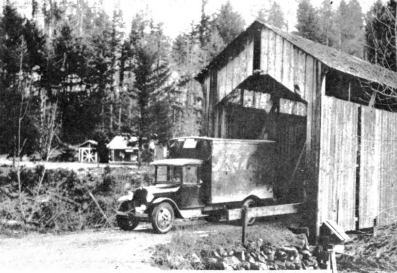
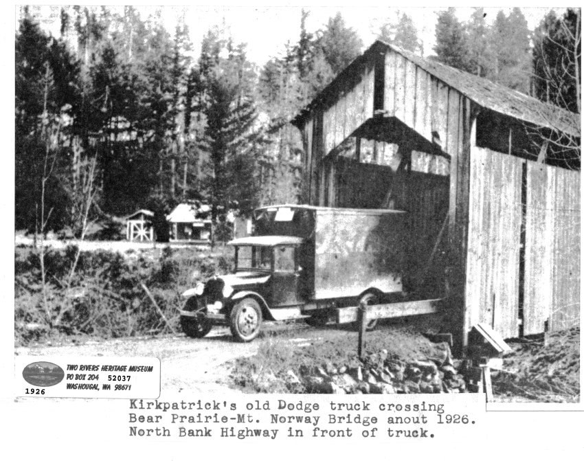
1926 - Mt Norway-Bear Prairie Bridge
Located on what was called the North Bank Highway, Kirkpatrick’s old Dodge truck can be seen crossing Bear Prairie-Mt Norway bridge in about 1926. There is little historical reference to this covered bridge. Here is an excerpt from The Columbian’s Clark History – Bear Prairie: “Gerald and Louise Erickson live at the bottom of the Skye Road. Erickson was born near the covered bridge used by Bear Prairie residents to cross the Washougal.”
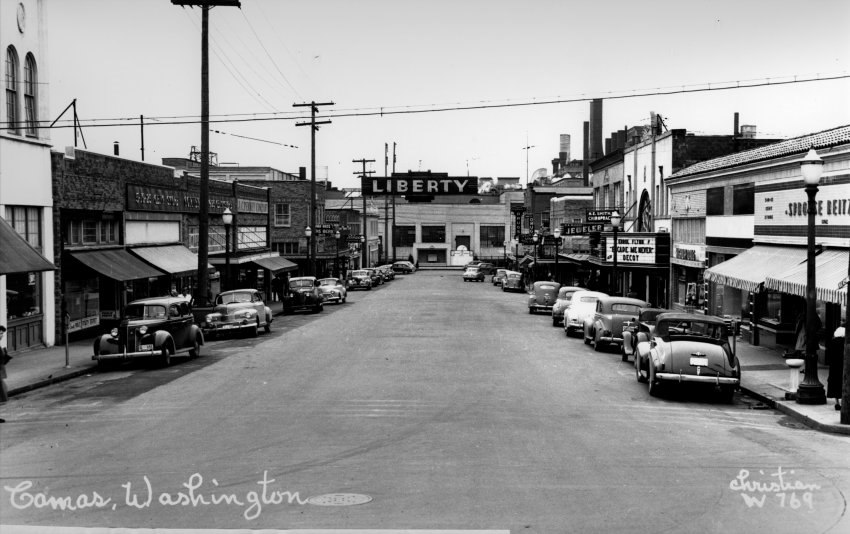
1940s - Downtown Camas
Looking west down NE 4th Ave, this iconic photo shows Downtown Camas in the 1940s. While the Paper Mill is visible at the end of the street, viewers are often confused by the Liberty Theater sign, which was suspended over 4th Ave at that time. This photo provides a second optical illusion, which is that in in 4th Ave appears to be wider than it is now. However, that is simply because of the adjustments made as part of Operation Foresight (or 4-Sight) during the 1960s! This project included beautification by adding planting areas for trees, flowers, and bushes, as well as improving logistics by adding in angled parking to maximize the parking capacity.
What new photos being taken today will become iconic historic photos in the future?
We can’t wait to find out!